Ultimate Guide to Marine Asset Tracking
How GPS, AIS, RFID and IoT secure and monitor vessels and equipment, reduce losses, and simplify compliance.
Marine asset tracking helps you monitor vessels, equipment, and tools across oceans and shores. By using technologies like GPS, AIS, and RFID, it provides real-time data on locations, usage, and compliance. This reduces asset losses, improves efficiency, and ensures safety standards are met.
Key takeaways:
- What it does: Tracks high-value assets like vessels or tools using GPS, RFID, and QR codes.
- Who needs it: Offshore operators, maritime logistics managers, and businesses managing equipment across locations.
- Why it matters: Prevents asset losses (5%-10% annually), reduces theft, and ensures compliance with regulations.
- Technologies: GPS for real-time tracking, AIS for fleet management, and RFID for inventory control.
- Benefits: Boosts security, cuts replacement costs, and simplifies compliance reporting.
Marine tracking systems are now more advanced, offering features like geofencing alerts, automated compliance, and multi-layered monitoring. This technology is crucial for managing assets effectively in the demanding marine industry.
How Does GPS Tracking Work For Marine Security? - Boat Life Masters
sbb-itb-499a7f0
Technologies Used in Marine Asset Tracking
Marine asset tracking combines several technologies, each tailored to specific needs. GPS tracking plays a central role, offering real-time location updates via cellular networks near the coast and satellite connections for open-sea operations. This technology significantly improves recovery rates for stolen vessels - 73% for GPS-tracked assets compared to just 15% for untracked ones. Additionally, recovery times for GPS-tracked vessels average 3.2 days, far quicker than the 28-day average for untracked assets.
Automatic Identification System (AIS), initially created to prevent collisions, has become essential for fleet management and compliance. Using VHF transponders, AIS broadcasts critical details such as a vessel's identity, position, speed, and voyage information to nearby ships and shore stations. It is mandatory for vessels over 300 gross tonnes on international voyages. While terrestrial AIS covers areas up to 40 nautical miles from the coastline, satellite AIS ensures global tracking, even in remote oceanic regions. As AXS Marine aptly states:
"AIS is the backbone of modern maritime visibility, analytics, and decision-making".
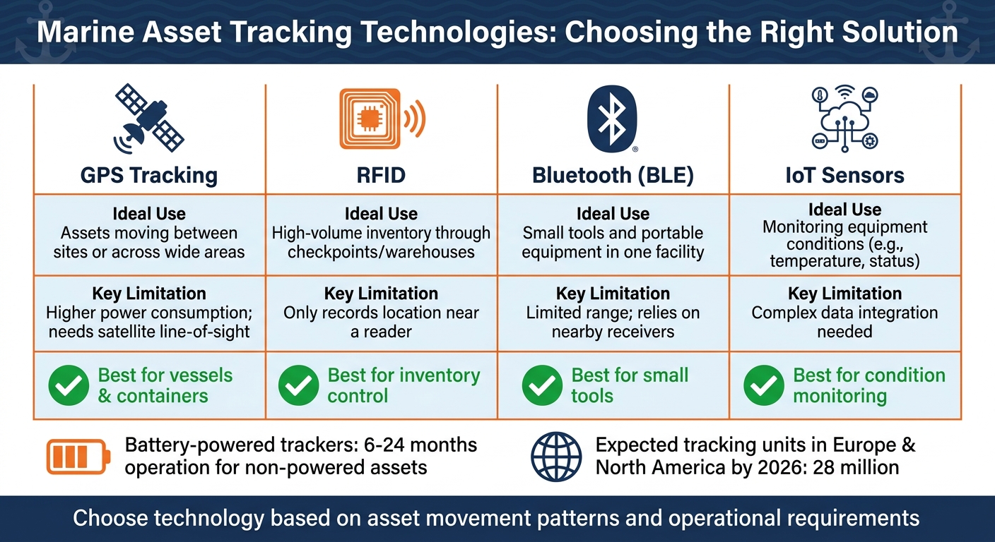
To complement GPS and AIS, sensor technologies enhance asset monitoring. IoT and RFID sensors go beyond location tracking, providing data on asset status and condition. Active RFID tags, powered by their own energy source, are ideal for long-range communication in large port areas, while passive tags work well at checkpoints and loading bays. Other technologies like LoRa (Long Range) offer signal transmission over several kilometres, making them suitable for expansive maritime environments. On the other hand, Bluetooth Low Energy (BLE) beacons provide precise tracking for smaller equipment in confined spaces. With the adoption of these technologies, the number of installed asset tracking units in Europe and North America is expected to hit 28 million by 2026.
Benefits of Marine Asset Tracking
Security and Theft Prevention
Marine asset tracking takes security from being reactive to being proactive. If assets move beyond their set operational hours or boundaries, the system sends instant alerts. As the GPX Team puts it:
"When GPS tracking is in place, these movements trigger immediate alerts instead of being discovered days later".
This real-time alert system is crucial, especially when considering theft statistics.
In Q3 2025, CargoNet reported 772 cargo theft incidents in the United States and Canada, with stolen goods valued at an astonishing £87.4 million. These thefts are no longer just opportunistic; organised criminal networks are now targeting high-value shipments. By late 2025, the average value of a stolen shipment had doubled to £263,200.
Tamper sensors add another layer of security by notifying operators as soon as someone attempts to interfere with the equipment. As the GPX Team explains:
"Providing live location data significantly increases the speed of recovery and bolsters law enforcement intervention".
The compact and discreet design of these tracking devices makes them hard for criminals to find and disable. Meanwhile, precise location data and detailed route histories allow law enforcement to recover stolen assets much faster.
How to Implement Marine Asset Tracking
Marine Asset Tracking Technologies Comparison: GPS, RFID, Bluetooth, and IoT Sensors
Implementing marine asset tracking involves a focused three-step process designed to enhance security and operational efficiency.
Step 1: Review Your Asset Inventory and Requirements
The first step is to identify the assets that genuinely require tracking using fleet telematics. A good rule of thumb is the "48-Hour Rule": prioritise any asset whose loss for 48 hours would disrupt operations or lead to significant costs. This typically includes heavy machinery, generators, specialised tools, and high-value equipment.
The construction and industrial equipment sector, which shares many similarities with marine operations, experiences annual theft losses ranging between £230 million and £770 million. Around 1,000 pieces of heavy equipment are stolen monthly, with fewer than 25% recovered without a tracking system. These numbers highlight the importance of cataloguing your most critical assets first.
Start with high-value items to test the system and refine your processes. This phased approach can help minimise confusion and ensure smoother implementation.
Step 2: Select the Right Tracking Technology
Choose tracking technology based on how your assets move and operate. Different technologies are suited to specific scenarios:
- GPS Tracking: Ideal for vessels, containers, and equipment travelling between ports or across large areas. However, it requires a clear line-of-sight to satellites and consumes more power.
- RFID: Best for high-volume inventory passing through checkpoints or warehouses. Its main limitation is that it only records location when near a reader.
- Bluetooth (BLE): Suitable for small tools and portable equipment within a single facility. Its range is limited and relies on nearby receivers.
- IoT Sensors: Useful for monitoring operational conditions like engine hours, fuel levels, or cargo temperature. However, integrating the data can be more complex.
| Technology | Ideal Use | Key Limitation |
|---|---|---|
| GPS Tracking | Assets moving between sites or across wide areas | Higher power consumption; needs satellite line-of-sight |
| RFID | High-volume inventory through checkpoints/warehouses | Only records location near a reader |
| Bluetooth (BLE) | Small tools and portable equipment in one facility | Limited range; relies on nearby receivers |
| IoT Sensors | Monitoring equipment conditions (e.g., temp, status) | Complex data integration needed |
For non-powered assets like trailers, discreet battery-powered trackers are a good choice. These devices can operate for 6–24 months and continue reporting even if power is lost. Hidden trackers also significantly improve recovery rates in cases of theft.
Once you've chosen the right technology, the next step is to centralise data through a monitoring dashboard.
Step 3: Connect Tracking to Monitoring Dashboards
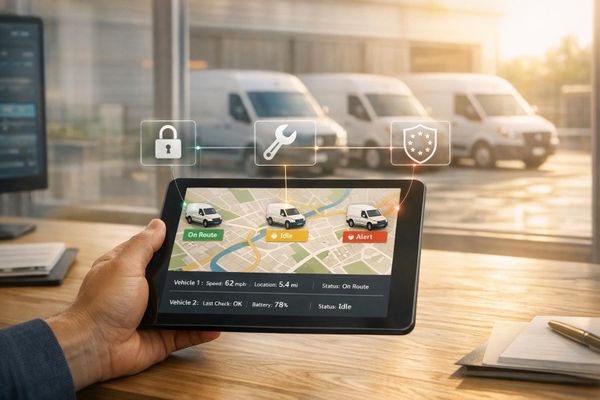
A centralised dashboard provides real-time visibility into asset locations, movement history, and connectivity. Opt for cloud-based platforms that allow managers to monitor assets remotely using laptops, tablets, or smartphones.
Ray Zujus from Verizon Connect highlights the evolving role of tracking systems:
"Modern asset tracking and management solutions are transforming how businesses operate, moving beyond simple location awareness to provide deep insights that enable proactive management".
Make sure your tracking provider supports open APIs. According to Tracking System Direct:
"A tracking solution that integrates with [existing] tools reduces manual data entry and keeps operations running from fewer screens".
Set up automated alerts for geofencing - virtual boundaries around areas like ports or shipyards. These alerts can notify you instantly via SMS or email if an asset moves unexpectedly or outside of working hours. Additionally, configure your dashboard to trigger service reminders based on actual engine hours or usage cycles, rather than relying on calendar dates. This automation not only reduces errors but also provides near real-time insights that manual methods simply can't match.
Best Practices for Managing Marine Assets
Once operations are underway, adopting a few targeted practices can significantly boost reliability and improve returns on investment.
Using Multiple Tracking Technologies
While GPS trackers provide real-time updates, they rely on uninterrupted satellite signals and stable power. In marine settings, power fluctuations or signal issues can disrupt tracking when it’s needed most. To counter this, using additional tracking systems ensures continuous visibility, even if the primary system fails. For remote vessels or crucial equipment, this redundancy is essential for quick recovery and uninterrupted monitoring.
By combining technologies, operators can also lay the groundwork for automated compliance and reporting processes.
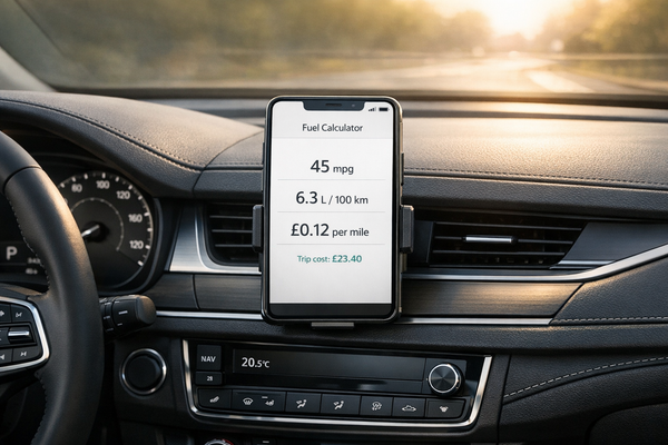
Automating Compliance and Reporting
Tracking compliance manually is both time-intensive and prone to mistakes. Automated systems simplify this by managing tasks like certificate renewals, safety drills, and emissions tracking. For instance, integrating fuel flow meters and emissions sensors with regulatory systems can automatically generate reports for IMO DCS and EU MRV requirements, eliminating the need for manual input.
Maria Petrova, Compliance Manager at Baltic Shipping Co, shared her experience with automation:
"Marine Inspection transformed our compliance management. We've had zero non-conformities in our last 5 port state inspections. The automated alerts are invaluable".
These systems not only reduce administrative tasks but also improve operational efficiency. For example, configuring alerts for certificate expirations at 90, 60, and 30-day intervals ensures deadlines are never missed. Sensor data combined with crew logs can produce comprehensive compliance reports, which can then be used for performance reviews. This strategy has helped large operators managing over 25,000 certificates maintain compliance rates as high as 98%.
Handling Marine Environment Challenges
Marine environments pose unique challenges that can affect asset performance. Saltwater, UV radiation, and harsh weather conditions are particularly tough on tracking hardware. Freshwater washdowns are a simple but effective way to remove corrosive salt deposits from GPS units and sensors. Regular electrical inspections also help maintain stable power, which is critical for reliable tracking.
When equipment is not in use, protective covers can shield it from UV rays, rain, and freezing temperatures, significantly extending its lifespan. Addressing corrosion early prevents more extensive damage to both the structure and electronics of assets. For vessels, routine hull maintenance - such as cleaning and painting - helps prevent barnacle build-up and blisters, which can interfere with sensor placement and performance.
Conclusion
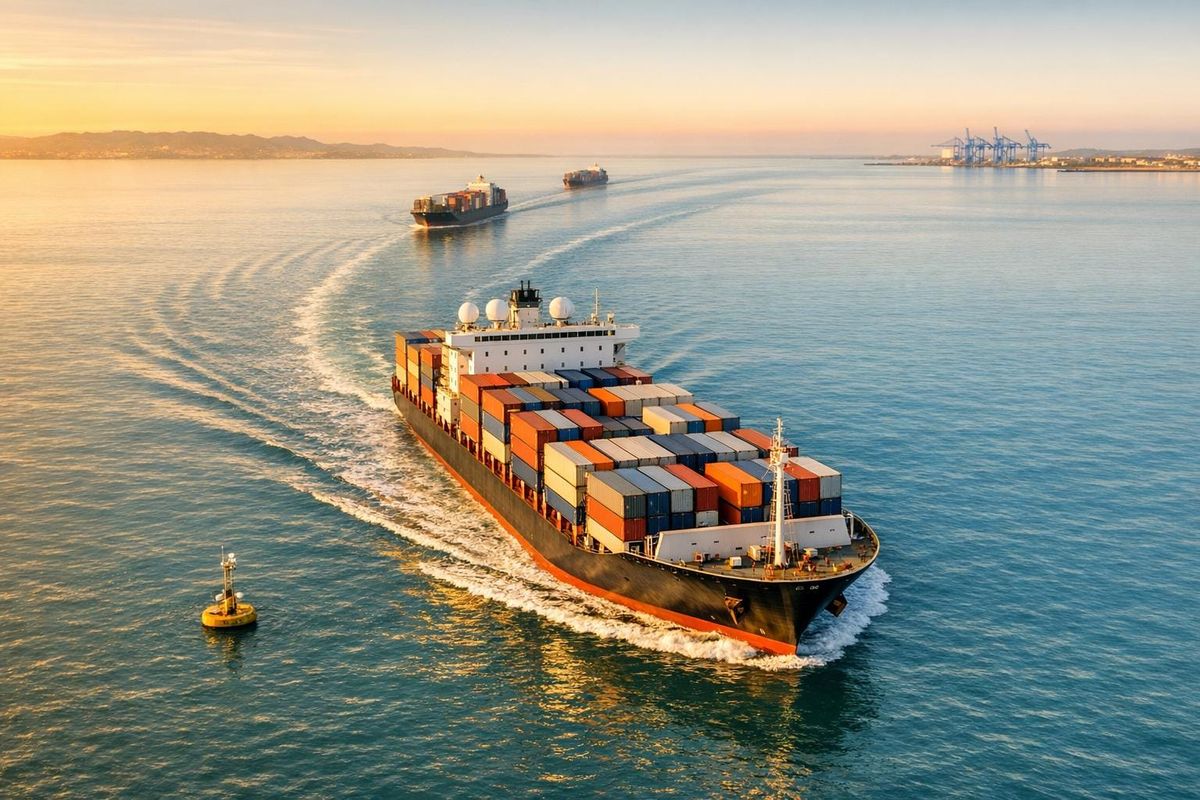
Marine asset tracking has become a critical tool for ensuring security, improving efficiency, and meeting regulatory demands. With over 90% of global trade moving by sea, the need for robust visibility and control over maritime assets has never been greater.
Today’s tracking systems go beyond simply identifying locations. They can detect AIS spoofing, screen vessels against sanction lists, and even automate emissions reporting to meet EU MRV and IMO DCS requirements. These features not only enhance operational control but also help prevent the financial and reputational fallout of non-compliance.
Failing to comply with regulations can have significant consequences. By employing multi-layered monitoring - integrating AIS, satellite imagery, and GNSS anomaly detection - operators gain the transparency needed to navigate complex maritime rules while maintaining a competitive edge.
As Professor Adolf K. Y. Ng explains:
"Maritime transportation served as the 'blood circulation' of the global economy through linking marine corridors into complex shipping networks".
Safeguarding this vital network calls for forward-thinking investments in tracking technologies. These systems are capable of monitoring over 220,000 vessels and analysing more than 2 million trades to uncover hidden risks. Such tools form the backbone of operational strategies in today’s demanding maritime landscape.
Whether managing a single vessel or an entire fleet, adopting practices like redundant tracking, automated compliance, and proactive environmental monitoring transforms tracking into a strategic advantage. These measures protect assets, simplify port operations, and ensure smooth sailing in an industry facing increasing scrutiny.
FAQs
Which tracking tech is best for my marine assets?
When it comes to tracking marine assets, the right technology depends on your specific requirements. However, satellite GPS trackers are known for their dependability. These trackers utilise systems such as GPS, GLONASS, and Galileo, ensuring robust coverage even in isolated locations.
Key features to consider include:
- IP68 durability to withstand harsh weather conditions.
- Dual-tracker setups for added reliability.
- High-security certifications, like Thatcham or TASSA, to ensure advanced protection.
Additionally, you can choose between hardwired options for fixed assets or battery-powered solutions for mobile ones, offering versatility to suit various scenarios.
How do trackers work offshore without mobile signal?
Offshore trackers utilise satellite-based GPS technology, which functions independently of mobile networks. These devices depend on global navigation satellite systems (GNSS) like GPS, GLONASS, or Galileo to pinpoint exact locations.
The location data is then transmitted through satellite communication networks, such as Iridium or Inmarsat. This ensures worldwide coverage, even in the most remote parts of the oceans, making them indispensable for monitoring assets where cellular or Wi-Fi signals are unavailable.
How can tracking automate IMO DCS and EU MRV reporting?
Tracking takes the hassle out of IMO DCS and EU MRV reporting by delivering precise, real-time data on fuel usage, vessel performance, and operational stats. For IMO DCS, it records fuel consumption and generates thorough reports that meet compliance standards. Meanwhile, for EU MRV, it monitors CO₂ emissions, vessel speed, and distance travelled, producing audit-ready records. This approach minimises manual errors, simplifies compliance processes, and makes reporting far more efficient.