UK BVLOS Rules: What Logistics Firms Need to Know
Overview of UK CAA BVLOS rules, UK SORA approvals, AAE/urban/fully integrated pathways and tech requirements for logistics firms.
Drones flying beyond visual line of sight (BVLOS) are transforming logistics in the UK. They enable longer delivery distances, bypass road traffic, and reduce emissions. Using fleet telematics alongside drone technology, the UK Civil Aviation Authority (CAA) is working towards routine BVLOS operations by 2027, with clear rules and pathways already in place. Logistics firms must understand these regulations to take advantage of BVLOS opportunities.
Key Points:
- BVLOS Benefits: Faster deliveries, reduced costs, and increased efficiency for middle-mile and last-mile logistics.
- Regulations: Operators must comply with the UK SORA framework, submit detailed safety cases, and meet airspace requirements.
- Approval Process: Requires robust safety systems, such as Detect-and-Avoid (DAA) technology, and adherence to CAA guidelines like CAP 3008 and CAP 3040.
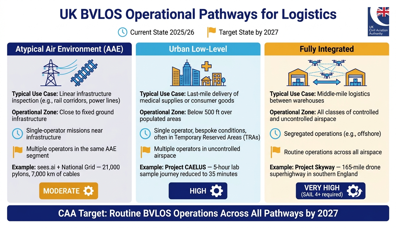
- Pathways: Three operational pathways - Atypical Air Environment (AAE), Urban Low-Level, and Fully Integrated - each suited to different logistics use cases.
- Future Outlook: CAA aims for full integration of BVLOS drones into UK airspace by 2027, offering significant opportunities for logistics firms.
To participate in this shift, businesses must align their strategies with regulations, invest in essential technology, and engage with the CAA early. BVLOS is shaping the future of logistics, and preparation is key.
Current UK BVLOS Rules and Regulations
What BVLOS Operations Involve
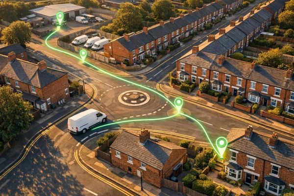
BVLOS (Beyond Visual Line of Sight) operations go beyond the standard limits of a pilot's direct line of sight. This capability allows drones to travel over long distances, including across remote landscapes, infrastructure corridors, and urban pathways, all managed through automation and remote monitoring. For logistics companies, this opens up new possibilities for efficient middle-mile and last-mile deliveries that cannot be achieved under the constraints of Visual Line of Sight (VLOS) rules.
These drones rely heavily on onboard sensors, GPS systems, and advanced Detect and Avoid (DAA) technology to ensure safe operation without a pilot physically observing them. This makes BVLOS ideal for tasks such as delivering packages in rural areas, inspecting utility networks, or providing supplies to remote communities - situations where traditional delivery methods like van tracking solutions would be slower, more expensive, or simply impractical.
UK CAA Guidelines for BVLOS
In the UK, most BVLOS operations fall into the "Specific" category of drone regulation. This means operators must obtain formal authorisation from the Civil Aviation Authority (CAA) before conducting any flights.
The regulatory framework centres on the UK SORA (Specific Operations Risk Assessment). This assessment requires operators to define their operational areas in detail, including:
- Flight Volume: The planned route.
- Contingency Volume: Space reserved for emergencies.
- Ground Risk Buffer: A designated safe landing zone.
These areas must be mapped out and submitted in KML/KMZ format using latitude and longitude polygons.
The CAA also requires technical data to ensure safety. For instance, fixed-wing drones must include information on their turn radius and glide ratios, while multi-rotor drones must provide ballistic descent calculations. The key reference for these requirements is CAP 3008, the UK Guide to BVLOS in the Specific Category.
In June 2026, the CAA introduced an additional policy under CAP 3040, known as the Atypical Air Environment (AAE). This policy enables BVLOS flights at low altitudes near ground infrastructure like power lines or buildings, where conventional aircraft are less likely to operate. One early adopter, sees.ai, partnered with National Grid Electricity Transmission to inspect pylons and overhead cables across England and Wales.
"Our new policy paves the way for new ways drones will improve everyday life. It not only enhances the operational capabilities of drones, but also promises widespread societal benefits across different sectors." - Sophie O'Sullivan, Director of Future of Flight at the UK Civil Aviation Authority
These guidelines set the foundation for BVLOS operations, but operators must also navigate specific airspace restrictions to ensure safety.
Airspace and Operational Constraints
BVLOS operators must comply with regulations surrounding Temporary Reserved Areas (TRAs), which are managed by an Air Navigation Service Provider and follow the Airspace Change Process outlined in CAP 1616. Within these TRAs, the CAA may impose additional requirements, such as Transponder Mandatory Zones (TMZ) or Radio Mandatory Zones (RMZ). Furthermore, Electronic Conspicuity - a system that allows DAA technology to detect other aircraft - is considered critical for operations in these environments.
Here’s a summary of the airspace constraints that logistics firms need to consider:
| Constraint | Mechanism | Relevant Guidance |
|---|---|---|
| Airspace segregation | Temporary Reserved Areas (TRA) | CAP 2533 |
| Formal airspace change | Sponsorship for DAs or TSAs | CAP 1616 |
| Safety buffers | Ground Risk Buffer & Contingency Volume | UK SORA |
| Infrastructure-adjacent flights | Atypical Airspace Environment (AAE) | CAP 3040 |
| Technical detection requirement | Electronic Conspicuity (TMZ/RMZ) | Airspace Modernisation Strategy |
Operators are advised to limit their applications to a single AAE per submission, as each environment requires a detailed and specific safety case. Keeping proposals focused and well-defined typically leads to a more streamlined approval process.
sbb-itb-499a7f0
How to Get Approval for BVLOS Operations
What You Need for Operational Authorisation
To gain approval from the CAA for Beyond Visual Line of Sight (BVLOS) operations, you need to prove that your plans ensure the safety of both airspace users and the public.
Start by consulting CAP 3008, the CAA's main guide for BVLOS operations within the Specific Category. Additionally, refer to CAP 2533, which deals with airspace management for such operations. If your route requires reserved airspace, you’ll need to follow the Airspace Change Process outlined in CAP 1616. Keep in mind that this process can take time, so plan accordingly.
Two technical elements are absolutely essential: a reliable Detect and Avoid (DAA) system and electronic conspicuity. Your application must address these alongside all other technical safety requirements.
You’ll also need to prepare a safety case based on the UK SORA framework. This should include details like your operational volume, contingency volume, and ground risk buffer. All coordinates must be submitted in KML or KMZ format, along with technical performance data - such as ballistic descent calculations for multi-rotor drones or turn radius and glide ratios for fixed-wing drones.
Below is a streamlined guide to help you navigate the approval process for BVLOS operations.
Step-by-Step Approval Process
-
Review CAP 3008 and CAP 2533
These documents are your starting point. CAP 3008 outlines the application requirements for the Specific Category, while CAP 2533 explains how to integrate your operations into existing airspace. This knowledge will shape your entire application. -
Define Your Operational Volumes
Clearly map out your planned flight area, contingency zones, and ground risk buffers as required in your safety case. Use JARUS SORA Annex A and F for guidance on calculation methods, and ensure all coordinates are in KML or KMZ format. -
Assess Your Airspace Needs
If reserved airspace is necessary, begin the CAP 1616 Airspace Change Process early. This step can be time-intensive, so it’s wise to start it while working on your safety case. -
Build Your Safety Case
Create a focused safety case that demonstrates how risks are minimised. If your application involves an Atypical Air Environment (AAE) policy, such as operating near power lines or buildings, limit your submission to one AAE to avoid overly complex arguments. -
Submit and Engage with the CAA
Once your documentation is complete, submit your application to the CAA. The authority is actively gathering evidence to support the transition from segregated trial areas to routine BVLOS operations, so presenting robust data will enhance your chances of approval.
"Safety is everyone's priority. To achieve our goal, we must make sure other airspace users are sufficiently protected, and the risk to people and property on the ground is minimised." - UK Civil Aviation Authority
For instance, in June 2026, the CAA spotlighted a collaboration between sees.ai and National Grid Electricity Transmission. John McKenna, CEO of sees.ai, commented:
"AAE is a big step towards routine BVLOS operations in public airspace. We applaud the UK Civil Aviation Authority for recognising this opportunity and diligently shaping this policy."
This project, which involved inspecting 21,000 pylons and 7,000 km of overhead cables from a central control room, illustrates the scale and potential of BVLOS operations once full authorisation is achieved.
Drones approved to fly beyond visual line of sight in atypical operations by UK CAA
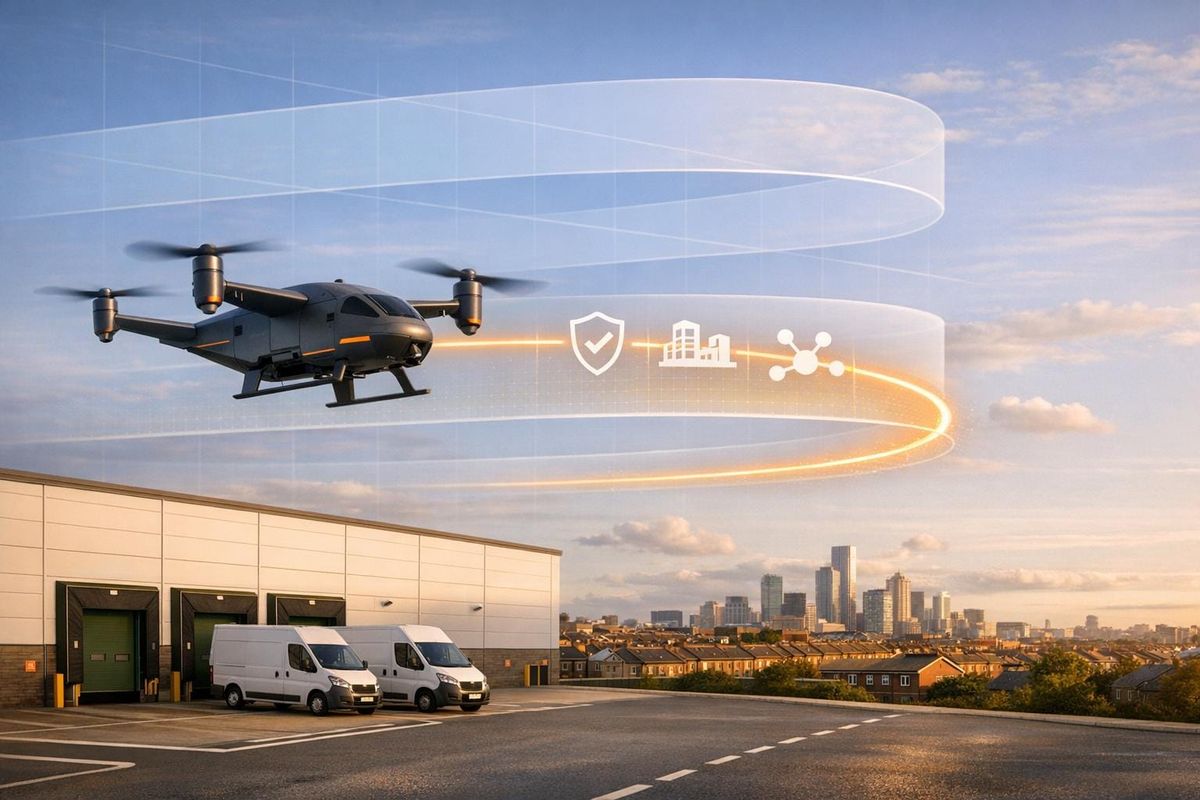
How BVLOS Affects Logistics Operations
UK BVLOS Operational Pathways: Which Route Is Right for Your Logistics Firm?
Benefits for Logistics Firms
BVLOS (Beyond Visual Line of Sight) operations allow drones to fly directly between points without requiring a pilot's visual observation. This direct routing avoids traffic delays and significantly reduces delivery times. For instance, Scotland's Project CAELUS demonstrated this by slashing a 5-hour lab sample transport journey down to just 35 minutes.
Another major advantage is scalability. Instead of relying on one pilot per drone, logistics companies can transition to automated systems, such as "drone-in-a-box" hubs, managed remotely. These hubs use UAS Traffic Management systems to handle flight planning and avoid collisions. A great example is Project Skyway, launched in July 2023 by Altitude Angel and BT. This initiative established a 165-mile drone superhighway in southern England. By using ground-based sensors to provide a shared airspace view, it enabled safe BVLOS operations without the need for bulky onboard sensors. This approach sets the stage for creating high-volume, routine delivery networks.
While BVLOS offers clear operational benefits, implementing it safely comes with its own set of challenges.
Challenges and Considerations
To operate BVLOS, logistics firms must meet strict requirements, including robust Detect-and-Avoid systems, electronic conspicuity, and redundant Command-and-Control links. These elements are critical for securing operational authorisation and should be factored into budgets early in the planning phase.
Additional hurdles include pilot qualification standards and concerns outside aviation, such as cybersecurity and privacy. Building a pool of qualified pilots alone requires significant time and effort.
"BVLOS is the advanced phase of UK drone operations. It is the single step that turns a drone from a visual-range tool into an infrastructure-scale instrument." - Peter Leslie, Founder, HireDronePilot
The table below outlines the three BVLOS operational pathways and their relevance to different logistics use cases:
| BVLOS Pathway | Typical Logistics Use Case | Operational Complexity |
|---|---|---|
| Atypical Air Environment (AAE) | Linear infrastructure inspection (e.g., rail, power lines) | Operates close to fixed ground infrastructure |
| Low-Level Urban | Last-mile delivery of medical supplies or goods | Airspace below 500 ft over populated areas |
| Fully Integrated | Middle-mile logistics between warehouses | Covers all classes of controlled and uncontrolled airspace |
Understanding which pathway applies to a specific operation helps logistics firms identify the required safety measures, technology investments, and regulatory compliance needed to adopt BVLOS successfully in the UK.
The Future of BVLOS in the UK: What to Expect
UK BVLOS Roadmap to 2027
The UK Civil Aviation Authority (CAA) has set an ambitious goal: routine BVLOS (Beyond Visual Line of Sight) operations across the nation by 2027. This is part of an active regulatory programme with clear milestones already in progress.
The roadmap outlines three operational pathways - Atypical Air Environment (AAE), Urban Low-Level, and Fully Integrated - each advancing through different levels of development. Here's a quick look at how things stand now and where they're headed by 2027:
| Pathway | Current State (2025/26) | Target State (by 2027) |
|---|---|---|
| Atypical (AAE) | Single-operator missions near infrastructure | Multiple operators in the same AAE segment |
| Urban Low-Level | Single operator, bespoke conditions, often in TRAs | Multiple operators in uncontrolled airspace |
| Fully Integrated | Segregated operations (e.g., offshore) | Routine operations across controlled and uncontrolled airspace |
The overarching aim is to move from accommodation - where drones operate under special conditions - toward integration, where drones share standard airspace alongside crewed aircraft. The 2026 Airspace Modernisation Strategy (AMS) will lay the foundation for this integrated airspace network.
"This technology has the potential to deliver huge benefits, and our roadmap sets out sensible and effective regulation that will enable the UK drone industry to continue to develop and grow." - Rob Bishton, Chief Executive, UK Civil Aviation Authority
The CAA is actively refining its policies based on live operational data.
Now, logistics firms need to align their strategies with this roadmap to ensure they’re ready for the upcoming changes.
How Logistics Firms Can Prepare
To stay ahead, logistics firms must match their operations to the correct pathway. For example:
- Deliveries along railway corridors fit under AAE.
- Urban medical supply runs align with Urban Low-Level operations.
- Warehouse-to-warehouse middle-mile networks suit Fully Integrated pathways.
Identifying the right category early can save businesses from costly adjustments down the line.
On the technology side, Electronic Conspicuity (EC) - such as ADS-B In/Out at 978 MHz or 1,090 MHz - will become a requirement for operations in Temporary Reserved Areas and eventually for integrated airspace. Additionally, adopting Unmanned Aircraft System Traffic Management (UTM) systems for flight planning and deconfliction will be essential, especially as operations expand.
Firms already conducting trials in segregated airspace have a distinct advantage. The performance data they collect during Detect and Avoid (DAA) testing will be invaluable for securing future technology approvals. In this case, data isn’t just a regulatory necessity - it’s a competitive edge.
"Over the coming months and years, the CAA is working to address the remaining regulatory challenges that will enable authorised operators to operate Beyond Visual Line of Sight (BVLOS) in a scaled, sustainable way." - UK Civil Aviation Authority
Keeping up with the CAA’s Future of Flight BVLOS roadmap (CAP3182) and airspace integration policies (CAP2533) will be critical for ensuring operational plans remain compliant with evolving standards.
Conclusion: Key Points for Logistics Firms
BVLOS operations are no longer just theoretical - they’re becoming a functional part of the logistics landscape, with routine implementation expected by 2027. The CAA has shifted from setting broad goals to issuing actual authorisations, fine-tuning policies based on real-world data, and establishing technical standards that will shape logistics for years to come.
To navigate this evolving landscape, logistics firms need to identify the operational pathway that aligns with their needs. For example:
- Infrastructure inspection along railways or power corridors falls under the Atypical Air Environment (AAE).
- Urban last-mile delivery, such as transporting medical supplies or consumer goods, is categorised as Low-Level Urban.
- Middle-mile networks with longer routes are part of the Fully Integrated pathway, which demands the highest technical standards, including SAIL 4+ safety assurance levels.
Once the pathway is clear, focusing on technical upgrades and pilot training becomes essential. Key investments include:
- Electronic Conspicuity systems (ADS-B In/Out at 978/1,090 MHz) and UTM systems, both critical for future integrated airspace.
- Robust C2 links, such as redundant cellular, satellite, or line-of-sight relay systems, which are subject to greater scrutiny as operations expand beyond segregated airspace.
- Pilot qualifications, transitioning from RPC-L1 to RPC-L2 for segregated airspace, and achieving RPC-L3 for full integration. RPC-L3 requires 50 BVLOS flight hours and a LAPL medical certificate.
Early collaboration with the CAA is more than just a compliance step - it’s an opportunity to influence the future of the industry. By sharing operational data and joining trials, firms can help shape scalable rules that will eventually govern all players. This proactive approach offers a competitive edge, ensuring companies are not just keeping up but actively contributing to the regulatory framework.
FAQs
How long does CAA BVLOS approval usually take?
The UK Civil Aviation Authority (CAA) generally requires anywhere from 2 to 12 months to approve Beyond Visual Line of Sight (BVLOS) operations. The timeline largely depends on factors like the complexity of the airspace and the safety measures involved.
For simpler cases, such as those involving visual mitigations, the process can take 2 to 4 months. However, more complex scenarios, like those requiring Temporary Reserved Areas, may extend the approval period to 8 to 12 months.
Engaging with the CAA early and submitting all required information promptly can help make the process smoother and potentially faster.
What BVLOS pathway fits my delivery route?
The best BVLOS (Beyond Visual Line of Sight) pathway for your operation depends on your delivery mission and the specific characteristics of your route. The Civil Aviation Authority (CAA) outlines five main pathways, which fall into two categories: those using segregated airspace and those relying on risk mitigation strategies.
For tasks like linear inspections along railways, the Atypical Air Environment (AAE) pathway works well. Meanwhile, last-mile deliveries over urban or populated areas are better suited to the integrated low-level BVLOS pathway. Regardless of the pathway chosen, you'll need an Operating Safety Case (OSC) to secure operational authorisation.
What data do I need to include in a UK SORA safety case?
When preparing a UK SORA (Specific Operations Risk Assessment) application, you'll need to provide detailed and structured information to demonstrate the safety and feasibility of your unmanned aircraft operations. Here's a breakdown of the essential data and requirements:
Operational Volumes and Risk Mitigations
-
Flight and Contingency Volumes: Define the geographical area of operation using precise coordinates (latitude/longitude) or polygons. Include the vertical extent of the operation, specifying the minimum and maximum altitudes in metres above ground level (AGL).
- Example: Operating area bounded by a polygon with coordinates (51.5074° N, 0.1278° W) to (51.5094° N, 0.1208° W), with a vertical extent of 50–120 metres AGL.
- Ground Risk Buffer: Calculate a buffer zone around the operational area to account for potential deviations or emergencies. This buffer is determined by the unmanned aircraft's performance characteristics, operational speed, and potential failure scenarios.
- Population Density: Provide data on the population density within the operational area, typically using publicly available maps or local authority statistics. Specify whether the area is sparsely populated, urban, or includes gatherings of people, as this impacts risk categorisation.
Unmanned Aircraft Specifications
Include the following technical details about your unmanned aircraft:
- Weight: Provide the maximum take-off weight (MTOW) in kilograms.
- Dimensions: State the aircraft's length, width, and height in metres.
- Speed: Specify the cruising and maximum speeds in metres per second (m/s).
- Power Source: Describe the type of power system (e.g., battery-powered, hybrid).
- Safety Systems: Highlight features such as parachute systems, geo-fencing, or return-to-home capabilities.
Crew Training and Competence
Provide evidence of the crew's qualifications and training, including:
- Remote Pilot Competency: Certificates or proof of training, such as General Visual Line of Sight Certificate (GVC) or equivalent.
- Operational Experience: Documented flight hours or prior experience with similar operations.
- Emergency Procedures Training: Evidence that the crew has been trained to handle contingencies such as loss of control or communication.
Airspace Class and Operational Procedures
- Airspace Class: Specify the class of airspace where the operation will take place (e.g., Class G for uncontrolled airspace). If operating in controlled airspace, include permissions from relevant authorities.
- Operational Procedures: Outline standard operating procedures (SOPs), including:
- Pre-flight checks
- Communication protocols
- Emergency response plans
- Maintenance schedules
Safety Technologies and Mitigations
- Detect-and-Avoid Systems: Detail the technology used to prevent collisions, such as radar, ADS-B receivers, or optical sensors.
- Redundancy Systems: Describe backup systems for critical components like communication links or power supplies.
- Contingency Plans: Explain measures to handle scenarios like GPS loss, battery failure, or adverse weather conditions.
By providing this comprehensive information, you'll address both the operational and safety aspects required for a SORA application, increasing the likelihood of approval for your unmanned aircraft operations in the UK.