GPS vs GLONASS: Choosing the Right Fleet Tracking System
Explore the differences between GPS and GLONASS for fleet tracking, and discover which system best suits your operational needs.

Looking for the best fleet tracking system? Here's what you need to know:
- GPS: Offers global coverage, accurate within 5 metres, and is ideal for urban and suburban areas.
- GLONASS: Excels in high-latitude regions like northern Scotland, with faster signal acquisition in some conditions but slightly less precise accuracy.
- Dual System (GPS + GLONASS): Combines the strengths of both systems for improved reliability, especially in challenging environments like dense urban areas or remote regions.
Quick Comparison
| Feature | GPS | GLONASS | Dual System (GPS + GLONASS) |
|---|---|---|---|
| Accuracy | Within 5 metres | Variable | Within 1.5 metres |
| High-Latitude Performance | Good | Excellent | Excellent |
| Signal Acquisition | Standard | Rapid in some conditions | Rapid and reliable |
| Best Use | Urban/suburban areas | High-latitude/remote areas | Mixed environments |
Key Takeaway: For most fleets, a dual-system approach ensures the best accuracy and coverage, reducing signal issues in both urban and remote areas.
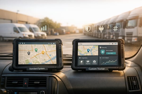
SEEWORLD | G20L 8-wire Tracker using GPS/BDS ...
System Performance
Fleet tracking efficiency depends on the specific operating conditions. GPS works reliably in urban and suburban settings, while GLONASS offers advantages in certain geographic areas.
GPS Tracking Range
GPS tracking systems provide precise fleet tracking, with an accuracy of up to 5 metres. This consistency is maintained across most of the United Kingdom, particularly in low-to-mid latitude regions. This level of precision is ideal for managing fleets in urban environments.
GLONASS Tracking Range
GLONASS performs exceptionally well in high-latitude areas, making it particularly useful for fleets operating in northern Scotland and other remote regions. Its orbital setup ensures strong coverage in these areas, delivering quick signal acquisition and reliable positioning. These features make it a strong choice for navigating challenging terrains, as shown in the performance comparison below.
Performance Metrics Comparison
Here’s how GPS and GLONASS stack up:
| Performance Metric | GPS | GLONASS |
|---|---|---|
| Urban Accuracy | Within 5 metres | Slightly less precise |
| Signal Acquisition Time | Standard | Faster in some conditions |
| High-Latitude Performance | Good | Excellent |
| Signal Stability | Highly stable | Slightly variable |
In areas with dense buildings, combining GPS and GLONASS improves tracking accuracy and reliability. Using both systems together ensures more dependable performance.
Signal Coverage
Accurate signal reception is essential for making timely and informed fleet decisions.
GPS Network Range
The GPS network provides coverage across the United Kingdom, performing particularly well in central and southern areas. In cities like London, Manchester, and Birmingham, GPS offers accuracy within approximately 5 metres. However, dense urban environments with tall buildings, as well as tunnels and other obstructions, can temporarily disrupt signals.
GLONASS Remote Tracking
GLONASS, on the other hand, excels in higher latitudes, making it a valuable option for operations in regions such as Scotland. Its unique satellite configuration enhances visibility and tracking precision, especially in remote areas where GPS may struggle. This makes it a strong complement to GPS in challenging environments.
Signal Quality
Signal performance for both systems depends on environmental factors and location. Here's a comparison of how GPS and GLONASS stack up in different conditions:
| Environment | GPS Performance | GLONASS Performance |
|---|---|---|
| Urban Centres | Accurate but affected by tall buildings | Reliable, with an edge in higher latitudes |
| Northern Regions | Good coverage with occasional gaps | Stable and more effective in these areas |
| Foliage | Prone to interference | Faces similar challenges |
| Tunnels | Limited functionality | Limited functionality |
| Open Roads | Highly accurate (around 5 metres) | Consistently reliable with slight variations |
Modern systems often combine GPS and GLONASS to ensure consistent signal coverage across varied terrains. This dual approach helps fleet managers maintain reliable operations in diverse conditions.
Fleet Manager Guide
Device Support
Fleet tracking devices work with various satellite systems. Here’s a quick comparison:
| System Type | Coverage | Best For | Average Accuracy |
|---|---|---|---|
| GPS-only | Global | Standard fleet operations | Within 2 metres |
| GLONASS-only | Northern regions | Fleets in high-latitude areas | Within 3 metres |
| Dual System | Broad and combined coverage | Mixed-environment fleets | Within 1.5 metres |
These specifications affect both the cost and the efficiency of your fleet tracking setup.
Price Analysis
The choice of system impacts your total costs. Consider these factors:
- Initial hardware costs: Vary by system type.
- Monthly subscription fees: £7.99 per vehicle.
- Installation expenses: Depends on fleet size and complexity.
- Savings: Efficient routing reduces fuel costs, and enhanced security may lower insurance premiums.
For example, the GRS Fleet Telematics dual-system package costs £79 per unit. It provides reliable coverage and performance across diverse conditions.
System Benefits
Dual-system tracking combines GPS and GLONASS, offering improved accuracy and coverage. Here’s how it enhances fleet management:
| Benefit Area | GPS Features | Extra Advantages with GLONASS |
|---|---|---|
| Route Optimisation | Accurate tracking for better routes | Performs better in high-latitude areas |
| Vehicle Security | Supports recovery efforts | Stronger signal reliability |
| Driver Safety | Monitors speed in real time | More precise positioning |
| Fleet Efficiency | Real-time location updates | Improved tracking in urban settings |
The GRS Fleet Telematics Ultimate package, priced at £99, includes both systems and advanced features like immobilisation. This option is ideal for fleets operating in cities, where tall buildings can interfere with satellite signals.
GRS Fleet Telematics Systems

Core Functions
GRS Fleet Telematics offers real-time tracking, theft prevention, and driver safety monitoring. Key features include:
| Feature | Function | Benefit |
|---|---|---|
| Geofencing | Sets virtual boundaries | Sends alerts for unauthorised usage |
| Speed Monitoring | Tracks vehicle speed live | Promotes safer driving habits |
| Route Optimisation | AI-driven route planning | Improves fuel efficiency |
| Eco-driving Analytics | Evaluates driver performance | Helps cut operational costs |
Combined System Benefits
Using both GPS and GLONASS technologies, GRS Fleet Telematics ensures precise tracking and improved vehicle utilisation. This setup helps reduce downtime, cut maintenance expenses, and enhance logistics efficiency. Impressively, the dual tracking system has achieved a 91% vehicle recovery rate, making it a reliable option for fleet security. The system is adaptable for fleets of various sizes, ensuring flexibility for different operational needs.
Fleet Size Options
GRS Fleet Telematics provides tailored solutions for fleets of all sizes:
| Package | Hardware Cost | Monthly Fee | Best Suited For |
|---|---|---|---|
| Essential | £35 | £7.99 | Small fleets (1–10 vehicles) |
| Enhanced | £79 | £7.99 | Medium fleets (11–50 vehicles) |
| Ultimate | £99 | £7.99 | Large fleets (50+ vehicles) |
All packages include full platform access, a dedicated account manager, and built-in SIM/data connectivity. The Ultimate package is ideal for organisations in demanding environments, featuring both GPS and GLONASS tracking and advanced security tools like immobilisation.
Conclusion
Select a fleet tracking system that aligns with your specific needs and geographical areas of operation. GPS provides dependable accuracy within 5 metres and global reach, making it a solid choice for most fleet activities. Meanwhile, GLONASS is particularly effective in high-latitude regions due to its orbital setup.
Using both systems together enhances tracking reliability in cities and offers better overall visibility of operations.
Here’s a quick comparison to guide your decision:
| Operating Environment | Recommended System | Key Advantage |
|---|---|---|
| Urban Areas | Combined GPS/GLONASS | Better signal in dense areas |
| High Latitudes | GLONASS-priority | Stronger performance in northern regions |
| Global Operations | Combined GPS/GLONASS | Greater reliability worldwide |
| Standard Routes | GPS | Precise 5-metre accuracy |
Integrating both systems ensures better accuracy, reliability, and coverage, making it a smart choice for modern fleet tracking.
For fleet managers in the UK and Europe, a dual-system approach bridges coverage gaps across diverse terrains, supporting everything from city deliveries to long-distance transport.
