Geofence Boundary Planner for Your Operations
Plan and visualise geofence boundaries for your business with our free tool. Easily draw zones on a map and manage operational areas!
Plan Your Operational Areas with a Geofence Boundary Planner
Managing a business or fleet often means keeping track of specific locations and ensuring everything runs smoothly within defined zones. That’s where a virtual boundary mapping tool comes in handy. This innovative solution lets you outline operational areas on an interactive map, making it easier to monitor movements, automate alerts, and streamline workflows.
Why Define Virtual Boundaries?
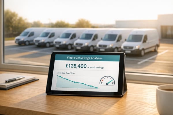
For industries like logistics, construction, or even retail with delivery services, knowing exactly where your assets or team members are is crucial. By setting up custom zones, you can create a system that notifies you when a vehicle enters or exits a designated space. This isn’t just about control—it’s about saving time and reducing errors. Imagine cutting down on manual check-ins or ensuring drivers stick to efficient routes without constant oversight.
A Tool Built for Practical Use
Our mapping solution offers a user-friendly way to draw and manage these zones, whether you’re covering a small local patch or a sprawling regional network. With features like area calculations and editable boundaries, it’s tailored for real-world needs. Try it out and see how visualising your operational spaces can transform the way you work.
FAQs
What is a geofence, and why should my business use one?
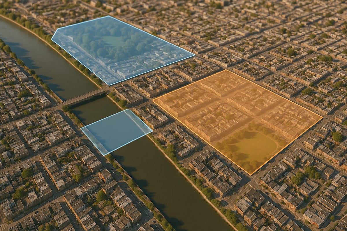
A geofence is a virtual boundary you set around a real-world area, often used for tracking or monitoring purposes. Think of it as an invisible fence that can alert you when vehicles or staff enter or leave a specific zone. For businesses, especially those with fleets or field operations, geofences are brilliant for improving efficiency, ensuring safety, and automating tasks like time tracking or delivery notifications. Our tool makes setting these up a breeze, even if you're not tech-savvy.
Can I create custom shapes for my geofence zones?
Absolutely! Our Geofence Boundary Planner lets you draw custom shapes on the map to match your exact needs. Whether it's a jagged property line or a neat circular radius around a hub, you've got full control. The tool also checks that your shape is closed properly, so there’s no guesswork involved. Once drawn, you can name the zone and see its approximate area in square miles or kilometres.
Is this tool suitable for small businesses with limited budgets?
Yes, it’s perfect for small businesses! Our planner is completely free to use, and it’s designed to be straightforward, so you don’t need fancy software or a big tech budget. You can define operational areas for deliveries, service zones, or even staff monitoring without spending a penny. Plus, the visual map output helps you communicate plans clearly to your team, saving everyone time and hassle.