5 AI Tools for Last-Mile Delivery Routes
Five AI routing tools that cut last-mile costs, reduce mileage, improve on-time delivery and handle urban limits like ULEZ and traffic.
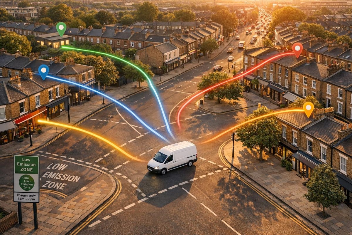
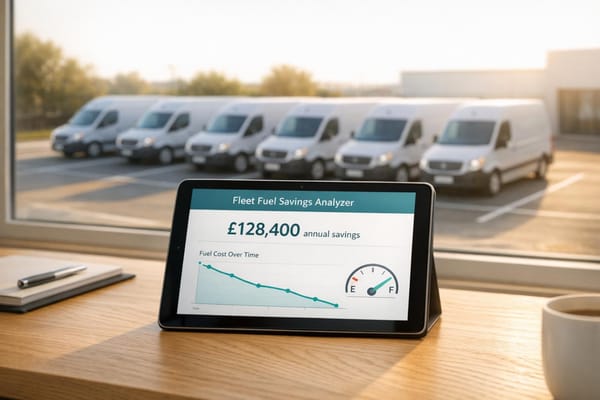
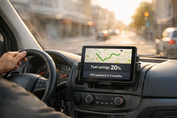
Last-mile delivery is one of the most challenging and expensive parts of logistics, making up nearly 50% of total delivery costs in the UK. Congested roads, tight delivery windows, and regulations like London's ULEZ charges add to the complexity. Traditional route planning often falls short, but AI tools are transforming the process by offering real-time traffic updates, predictive rerouting, and cost savings of up to 42p per mile in busy areas.
Here’s a quick look at five AI tools helping fleet operators optimise last-mile delivery:
- FarEye: Handles over 100 real-time factors, reducing planning time by 90% and boosting delivery success rates by 22%.
- Track-POD: Focuses on real-time adjustments, cutting delivery times and fuel costs with tools like dynamic departure scheduling.
- OptimoRoute: Plans routes up to 7x faster, increasing fleet efficiency and cutting fuel use by 15%.
- Bringg: Specialises in urban routing with features like AutoDispatch and multi-fleet support, increasing deliveries per vehicle by 63%.
- GRS Fleet Telematics: Combines route optimisation with advanced vehicle security, saving 42p per mile in congested areas.
These tools are helping UK businesses cut costs, improve delivery success rates, and comply with strict urban regulations. If you're facing high delivery costs or inefficiencies, investing in one of these solutions could be a game-changer for your fleet.
AI in Supply Chain: Last Mile Delivery, Logistics and Supply Chain Management | Richard Savoie
1. FarEye
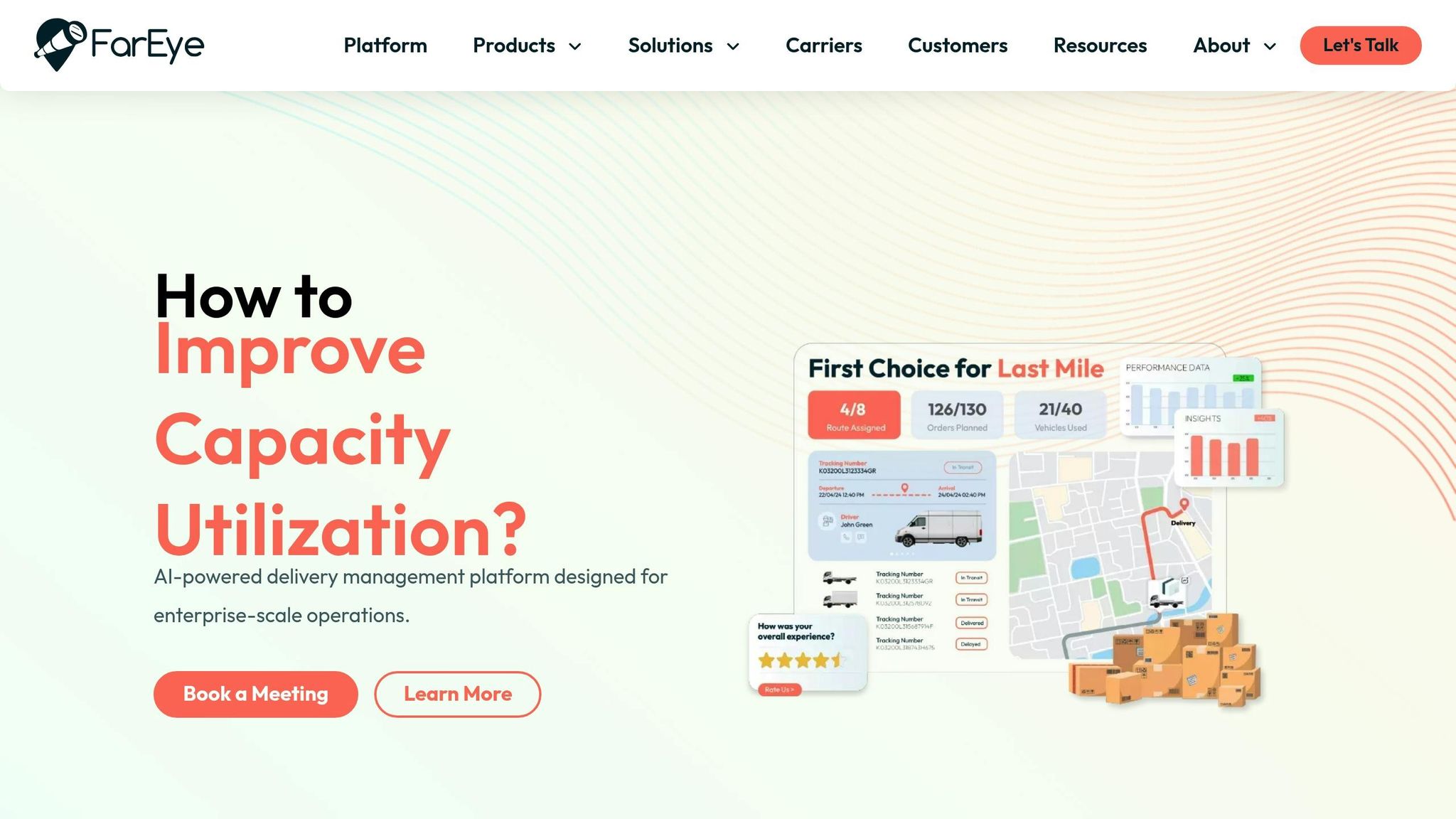
FarEye’s AI-driven platform simplifies the complexities of last-mile delivery in urban areas by managing over 100 real-time factors simultaneously. These include challenges like traffic jams, road closures, driver schedules, and vehicle capacities. When unexpected events occur - say, sudden congestion on the M25 or a new delivery request mid-route - the system recalculates routes on the spot. This efficiency has helped businesses cut over 75 million kilometres from their delivery routes, slashing greenhouse gas emissions by more than 550,000 metric tonnes.
Real-Time Route Optimisation
FarEye’s platform can plan over 1 million stops in less than 15 minutes, making route creation 90% faster than traditional manual methods. Dispatchers benefit from a centralised dashboard that issues proactive alerts, giving them the chance to reassign drivers or tweak schedules before delays snowball into missed deliveries.
For example, Blue Dart Express Ltd adopted FarEye’s unified routing system under the leadership of CIO Manoj Madhavan. This move led to a 22% boost in First Attempt Success Rate. The system’s "SMART Service Times" feature uses machine learning to predict stop durations by analysing historical data. It accounts for variables like building access quirks and time-of-day trends, ensuring precise stop time estimates.
While this speeds up planning, FarEye also adjusts to local traffic conditions, as explained below.
Urban Traffic Adaptation
FarEye’s platform goes beyond basic route updates by using geographic microgrids to analyse hyper-local traffic patterns. These grids predict delays specific to individual neighbourhoods and times of day. The system integrates what it calls "local expertise" - details like shortcuts, building entry procedures, and area-specific traffic behaviours that seasoned drivers know but standard GPS systems often overlook. This knowledge is continuously fed back into the system, refining future route suggestions for all drivers.
FarEye's real-time visibility capabilities and last-mile logistics platform have given us the ability to read dynamic market conditions and make more informed decisions on routing orders dynamically to achieve on-time, accurate deliveries.
- Dino Araneta, Founder, Chief Strategy & Innovations Officer, QuadX
Fuel Efficiency Improvements
Gordon Food Service, under the guidance of Innovation Manager Al Contreras, leveraged FarEye’s routing technology to achieve 8.6% sales growth while reducing carbon emissions through optimised driving routes. The platform’s EV routing functionality considers factors like charging station locations and vehicle range, ensuring electric vans don’t run out of power mid-delivery. This is particularly crucial as UK fleets increasingly adopt zero-emission vehicles to meet ULEZ and Low Emission Zone standards.
We needed routing software that would intelligently take a list of addresses and develop the most optimal driving route. By driving the optimal routes, we are decreasing our carbon footprint with fewer emissions, and we're using less fuel.
- Al Contreras, Customer Innovation Manager, Gordon Food Service
These improvements not only reduce fuel consumption but also enhance overall delivery performance for FarEye’s clients.
Delivery Success Rate Enhancements
One American cabinet manufacturer saw a 73% increase in delivery success and a 16% improvement in On-Time In-Full (OTIF) compliant deliveries after implementing FarEye’s optimisation tools. Additionally, their Net Promoter Score jumped by 34 points. FarEye’s precise geocoding capabilities eliminate common address-related issues, such as overlapping postcode boundaries or unclear building entrances - problems often encountered in dense urban areas. Across its client portfolio, FarEye consistently delivers a 6% rise in OTIF deliveries and an 18% reduction in average delivery costs.
2. Track-POD
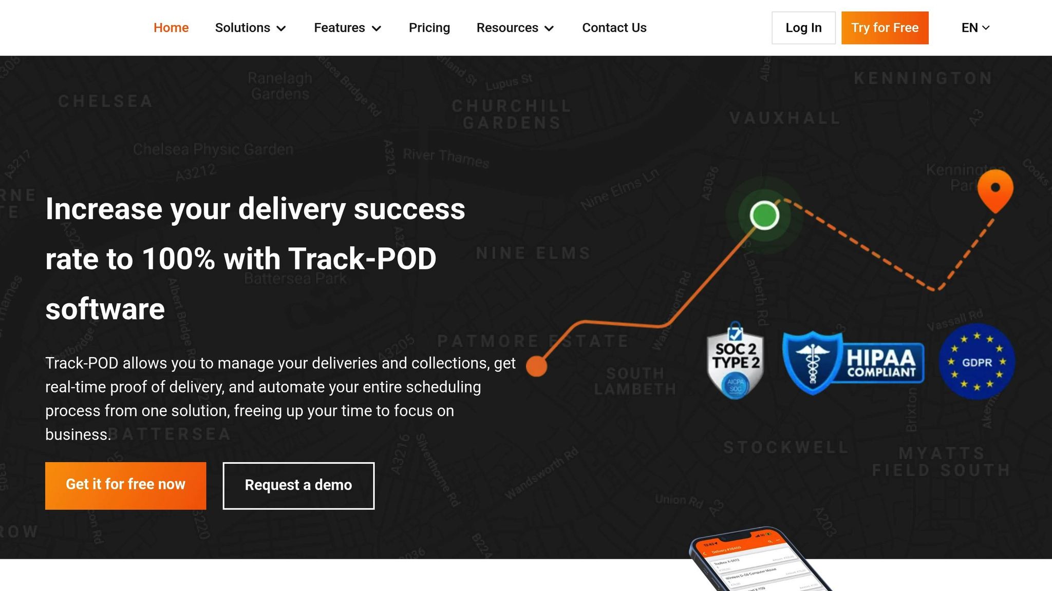
Unlike FarEye, Track-POD zeroes in on optimising departure schedules and adjusting routes in real time to meet immediate delivery demands. It automatically allocates orders by considering vehicle capacity and driver availability, ensuring an efficient workflow. Its Dynamic Departure Time feature delays driver start times until the first delivery window opens, cutting down on fuel use and minimising idle periods.
Real-Time Route Optimisation
Track-POD is designed to streamline planning and delivery, slashing these times by 35%. Many businesses have reported achieving on-time delivery rates as high as 99%. Rob Barr, Transportation Manager at Veritiv Canada, implemented Track-POD for his fleet of over 100 drivers and saw a dramatic improvement. The average delivery time dropped from 24 minutes to just 17 minutes per delivery, significantly boosting efficiency.
Track-POD dropped us from an average of 24 minutes per delivery down to 17 minutes per delivery, which is a huge saving when you have 100+ drivers. - Rob Barr, Transportation Manager, Veritiv Canada
The software recalculates ETAs every five minutes using live data. When delays occur, customers are automatically notified, reducing failed delivery attempts and improving overall satisfaction.
Urban Traffic Adaptation
To tackle urban delivery challenges, Track-POD offers a Geo Zones feature. This tool allows fleet managers to define boundaries around traffic-heavy areas like London's ULEZ zones or roadworks on the M6. Vehicles are then automatically rerouted to avoid these problem spots, saving time and reducing congestion-related delays. The system adjusts routes dynamically while drivers are on the move, bypassing jams and closures without manual input.
An idling tracker provides real-time white-label driver tracking insights, with colour-coded alerts: Green for under 10 minutes, Yellow for 10+ minutes, and Red for 20+ minutes of idling. Dispatchers can quickly identify delays and reassign deliveries using the Order Transfer feature, which allows seamless handoffs to nearby couriers. The updated Plan & Track 2.0 interface includes a "lasso tool" that lets managers group orders on a map and assign them to the best-suited driver, simplifying operations in dense urban areas.
These features not only improve delivery efficiency but also significantly cut fuel costs.
Fuel Efficiency Improvements
Track-POD optimises routes by sequencing stops to maximise deliveries per trip while minimising mileage and reducing the number of vehicles needed. This strategy has helped businesses boost profits by up to 25%, thanks to lower fuel consumption and better fleet management. The live idling tracker also helps dispatchers eliminate unnecessary fuel waste by flagging drivers stuck in traffic for extended periods.
Track-POD is one of the only all-in-one software options with good auto route planning, e-signatures, and live tracking. - Ian Nolan, Depot Operations Manager, GAP Ltd
Pricing for Track-POD starts at £69 per vehicle per month (billed annually) for the Advanced+ Plan. A seven-day free trial is available, and no credit card is required to get started.
3. OptimoRoute
OptimoRoute takes a smart approach to route planning, factoring in vehicle capacity, driver skills, and specific delivery time windows. This constraint-based planning is key for managing the challenges of urban deliveries, like tight schedules and capacity limits. In fact, the platform can plan routes up to 7 times faster than manual methods, making it a powerful tool for high-volume urban fleets. This level of precision lays the groundwork for improving overall performance.
Real-Time Route Optimisation
OptimoRoute offers live tracking and breadcrumb trails, allowing managers to monitor driver status in real time. It also features dynamic order assignment, which matches rush orders to drivers based on their location and current workload. Drivers receive updated routes, schedules, and navigation details directly on their phones, helping them adapt quickly to any changes.
"It has really streamlined our processes and allows us to make changes to our busy routes on the fly."
– Ann S., Logistics and Supply Chain
The platform also leverages route data to identify specific causes of service delays, which helps managers fine-tune future plans to deal with urban congestion. Alongside real-time tracking, these features contribute to cost savings, particularly in fuel efficiency.
Fuel Efficiency Improvements
OptimoRoute’s optimisation engine can cut driving time by up to 30%, significantly lowering fuel costs by balancing loads and maximising vehicle usage. Jonathan S. from the construction industry shared, "Since using OptimoRoute we have increased work time and decreased travel time. We also saved 15% yearly on fuel costs per truck". By considering vehicle capacities and driver costs, the software ensures efficient load distribution, reducing unnecessary trips and making the most of available resources.
Delivery Success Rate Enhancements
The software enables businesses to serve up to 43% more customers without increasing fleet size. Features like automated ETA updates, SMS/email tracking links, and a mobile app for capturing signatures and photos help minimise failed deliveries while confirming successful ones in real time. It even factors in specific unloading times - such as the 20 minutes typically needed to unload a truck - ensuring realistic arrival times even in traffic-heavy areas.
OptimoRoute’s pricing starts at £35.10 per driver per month (billed annually) for the Lite plan. The Pro plan, which includes real-time tracking and advanced analytics, is available at £44.10 per driver per month.
4. Bringg
Bringg stands out among AI tools with its specialised focus on urban routing, making it a go-to choice for businesses navigating the complexities of city deliveries.
By leveraging AI, Bringg evaluates traffic patterns, delivery points, and vehicle capacities to create dynamic routes that cut down both travel time and fuel consumption. Its machine learning engine, IntelliTOS, refines delivery estimates by analysing historical data. This includes factors like parking challenges and unloading times, which are particularly tricky in urban areas. Such precision helps tackle delays caused by hard-to-access locations or limited parking.
Real-Time Route Optimisation
For businesses handling on-demand deliveries, Bringg’s AutoDispatch feature assigns orders to drivers in real time, building efficient, on-the-fly routes to meet tight deadlines. The AI-driven system integrates live and predictive traffic data, adjusting routes instantly to account for road hazards, such as accidents or construction work. It even considers unique variables like driver expertise (e.g., handling temperature-sensitive items), vehicle dimensions, delivery zones, and eco-friendly delivery slots.
Adapting to Urban Traffic
Bringg’s routing system is tailored to urban environments, offering van tracking for rental and leasing companies that avoids restricted roads or low-clearance bridges. Its Route Clustering tool further streamlines operations by grouping deliveries to reduce overlapping routes and driver congestion, improving overall fleet efficiency.
Boosting Delivery Success Rates
Businesses switching from manual planning to Bringg’s AI-driven software have seen impressive results, including a 63% increase in deliveries per vehicle per route. Using machine learning to refine Estimated Time On Site (ETOS) has also helped one retailer boost their On Time In Full (OTIF) rate by over 6% in just six months. Additionally, automated customer communication and real-time tracking provide live ETAs, enabling customers to offer alternative drop-off instructions. This feature significantly reduces failed delivery attempts.
"Companies should look for AI delivery tools that aim to support drivers - not replace them."
– Bringg
Bringg’s multi-fleet support is another game-changer. Its optimisation engine can seamlessly manage a mix of owned fleets, third-party logistics providers, and gig workers. This flexibility is crucial for businesses operating across diverse urban landscapes. It’s a smart solution for companies juggling varied delivery resources in busy city settings.
5. GRS Fleet Telematics
GRS Fleet Telematics stands out by combining AI-driven route planning with advanced vehicle security, making it a go-to solution for last-mile delivery operations.
The platform uses machine learning and predictive analytics to process real-time data from TfL and National Highways. This enables it to reroute vehicles away from congestion hotspots, cutting delivery times by an average of 12 minutes and saving 42p per mile on fuel in traffic-heavy zones.
Smart Urban Navigation
Navigating complex urban environments is made easier with GRS's geofencing features. Virtual boundaries can be configured around high-risk areas, restricted zones, or low-emission regions across UK cities. If a vehicle enters these zones, instant alerts are triggered, helping businesses avoid fines and ensuring drivers stick to approved routes. With a tracking accuracy of 1.8 metres, the system provides real-time location updates, enabling swift responses to emergencies or route deviations.
Security That Protects Your Assets
Vehicle theft is a major concern for delivery services, and GRS Fleet Telematics tackles this with its dual-tracker technology. Available in the Enhanced (£79) and Ultimate (£99) packages, this system boasts a 91% recovery rate for stolen vehicles, supported by a 24/7 recovery team that works closely with UK law enforcement. According to the company:
Our dual-tracker system continues working even if thieves disable the primary device.
The system also includes tamper detection, which sends immediate alerts if the tracking hardware is interfered with. Paired with competitive pricing, this makes GRS a practical choice for businesses looking to protect their fleets.
Flexible Pricing for Growing Fleets
GRS offers three hardware packages to suit different needs: Essential (£35) for basic tracking, Enhanced (£79) with Bluetooth backup, and Ultimate (£99) featuring immobilisation capabilities. All packages come with a monthly software subscription of £7.99 per vehicle, covering SIM data, platform access, and an account manager. Installation is free when combined with fleet branding.
Technical Torque, a UK-based business, shared their experience:
Installation of trackers done promptly and professionally. System is fantastic, easy to use and has been an incredible asset to our company.
Feature Comparison
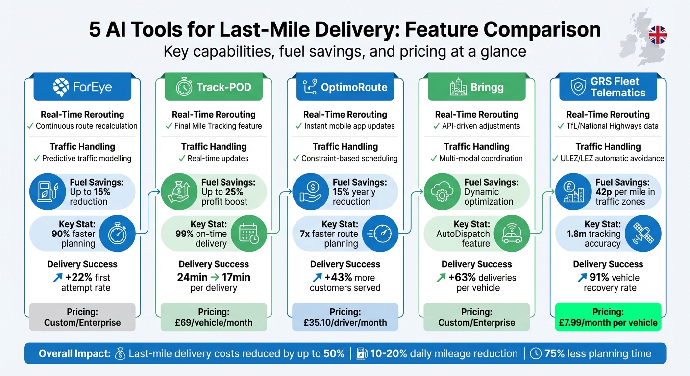
AI Last-Mile Delivery Tools Comparison: Features, Savings & Pricing
Here's a quick glance at how the evaluated AI tools stack up, showcasing their standout features and how they tackle urban last-mile delivery challenges like traffic management and pricing.
Selecting the best AI tool depends on your fleet's specific needs, budget, and operational size. The table below summarises how each platform handles key issues such as real-time traffic adjustments and cost efficiency.
| Tool | Real-Time Rerouting | Traffic Handling | Fuel Savings | Pricing (Starting) |
|---|---|---|---|---|
| FarEye | Continuous route recalculation | Predictive traffic modelling | Up to 15% reduction | Custom/Enterprise |
| Track-POD | Final Mile Tracking feature | Real-time updates | N/A | Custom |
| OptimoRoute | Instant mobile app updates | Constraint-based scheduling | N/A | Custom |
| Bringg | API-driven adjustments | Multi-modal coordination | N/A | Custom/Enterprise |
| GRS Fleet Telematics | TfL/National Highways data feeds | ULEZ/LEZ automatic avoidance | 42p per mile in traffic zones | £7.99/mo per vehicle |
For companies managing high-volume deliveries, enterprise solutions like FarEye and Bringg stand out with their customisation options through tailored pricing. On the other hand, OptimoRoute offers a middle ground, letting dispatchers manually tweak constraints without losing the benefits of AI-driven optimisation.
This comparison highlights how these tools address urban delivery challenges in unique ways, catering to a range of operational needs and priorities.
Conclusion
AI-powered routing tools have reshaped last-mile delivery, turning it from a reactive process into a predictive and data-driven operation. Tools like FarEye, Bringg, and GRS Fleet Telematics simplify the challenges of urban deliveries, making them more efficient and manageable. Choosing the right tool comes down to factors like fleet size, budget, and specific operational goals.
The numbers tell the story: AI routing can cut daily mileage by 10–20%, reduce manual planning time by as much as 75%, and save approximately 42p per mile in congested areas. With urban deliveries expected to rise by 78% by 2030, route optimisation isn't just a smart move - it’s a necessity to stay competitive.
Start by evaluating your current processes. Look at how much time you spend on route planning, your fuel expenses, and your on-time delivery rates. Then, consider running a three- to six-month pilot programme with part of your fleet to measure the potential return on investment.
As RTS Labs aptly states:
AI changes last-mile delivery from a reactive operation into a predictive, adaptive system.
To make the most of these advancements, revisit the feature comparison table and prioritise the capabilities that align with your needs. Whether your fleet consists of just a handful of vans or hundreds, the right AI routing platform can lower costs, boost reliability, and help you keep pace with growing customer demands in today’s increasingly complex urban delivery landscape.
FAQs
How do I choose the right AI routing tool for my fleet size?
Choosing the best AI routing tool comes down to factors like your fleet size, how complex your operations are, and what your delivery requirements look like. If you’re running a smaller fleet, a straightforward tool with basic route optimisation might be all you need. On the other hand, larger fleets, especially those operating in busy urban areas, will gain more from advanced systems that can tackle traffic patterns, local regulations, and vehicle capacity limits.
It’s also important to pick a tool that works seamlessly with your existing systems, can grow alongside your business, and is equipped to handle everyday delivery hurdles - things like failed delivery attempts, last-minute rush orders, or changes to customer schedules.
What data do I need to get accurate real-time rerouting?
To ensure accurate real-time rerouting, you’ll need access to live traffic data, weather reports, vehicle tracking information, and the status of active delivery orders or tasks. This combination allows routes to be adjusted dynamically, helping to sidestep delays and keep operations running smoothly.
How can AI routing help with ULEZ and other city restrictions?
AI-powered routing plays a key role in navigating Ultra Low Emission Zones (ULEZ) and other city restrictions by adjusting routes in real time to meet local regulations. By using live data - such as traffic conditions, weather updates, and regulatory zone boundaries - it can reroute vehicles to steer clear of restricted areas. This not only helps avoid fines and delays but also ensures compliance with legal requirements, boosts delivery reliability, and makes fuel use more efficient in cities with intricate environmental rules.